

Trace Planning

Town planners in Perth & regional WA

Trace Planning is the town planning team of Trace Enterprises, based in Osborne Park. We help landowners, builders and developers work out what their land can do, then take the application through to a decision: subdivision, development applications, rezoning and scheme amendments, and structure plans.

  • Subdivision & developmentFrom lot yield to new titles, and from development application to decision
  • Strategy & structure planningRezoning, structure plans and land use advice
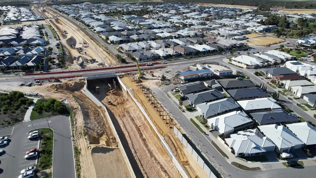
New houses and streets beside the rail corridor under construction at Alkimos, seen from above
Plate 01New streets & the rail corridor, Alkimos
Base
Osborne Park, Perth
Where we work
Perth and regional WA cities & towns
Decision-makers
Local governments, Development Assessment Panels and the WAPC
Framework
ACT Planning and Development Act 2005REG Local Planning Schemes Regulations 2015SPP 7.3 Residential Design Codes
01Who we work for

Town planning for landowners, developers & local government

From our office in Osborne Park, we work on sites across metropolitan Perth and regional WA, from single‑lot subdivisions to grouped dwellings on a steep clifftop. We deal with the local government and the Western Australian Planning Commission on your behalf.

For landowners, builders & developers

Homeowners, landowners, builders, developers & investors

We work out what your land can do, then prepare the application and the justification around what the assessing officer needs to decide it.

  • Lot yield assessments and subdivision applications
  • Development applications, R‑Code assessments and justification reports
  • Rezoning and change of use applications
  • Due diligence and development potential advice
Subdivision planning
For local government & agencies

Local governments, infrastructure providers & community organisations

Structure plans, local development plans, land use studies and stakeholder engagement for the authorities that plan for an area and decide what is built in it.

  • Structure plans and activity centre plans
  • Local development plans and urban design frameworks
  • Land use studies
  • Stakeholder identification and engagement
Strategic planning

Heritage & ecology checked in‑house

When a site carries a heritage listing, Aboriginal heritage or native vegetation, our Trace Archaeology and Trace Ecology teams check those constraints in‑house, so they can be dealt with before the application is lodged.

02Planning services

Subdivision, development approval, structure & strategic planning services

Our work runs from a single‑lot subdivision to a structure plan for a whole development area. Six specialisations cover it, and on larger projects we act as lead consultant.

Subdivision planning & approvals

The whole subdivision process for homeowners, investors and developers, from the initial lot yield assessment through to WAPC conditional approval and final condition clearance.

  • Lot yield assessments
  • WAPC subdivision applications
  • Green title, survey strata and built strata
  • Rural and residential subdivision
  • Condition clearance
  • Coordination with your licensed surveyor
Subdivision planning

Statutory planning

Development applications for residential, commercial, mixed‑use and industrial projects, prepared for how they will be assessed, including applications to Development Assessment Panels.

  • Development applications
  • R‑Code assessments and variations
  • Development Assessment Panel applications
  • Rezoning and change of use
  • Representation and advocacy
Statutory planning

Structure planning & urban design

Local and district structure plans, activity centre plans and local development plans, with Trace Planning acting as lead consultant and coordinating the technical disciplines each plan needs.

  • Local and district structure plans
  • Activity centre plans
  • Local development plans
  • Urban design frameworks
Structure planning

Strategic planning

Land use studies, planning feasibility and process advice that settle what a site can do, and the approval pathway it faces, before you commit to a design.

  • Land use studies
  • Planning feasibility
  • Opportunity and constraint analysis
  • Process and strategy advice
  • Stakeholder engagement
Strategic planning

Planning due diligence & advice

Due diligence investigations, site identification and development potential advice, with heritage and environmental constraints checked by our own teams in a single report.

  • Due diligence investigations
  • Site identification
  • Development potential advice
  • Development advocacy
Research & advice

Lead consultant & project management

One point of contact on multidisciplinary projects: the programme, the technical consultants, engagement with authorities and agencies, and regular reporting through to decision.

  • Programme management
  • Engineers, traffic, survey and urban design coordinated
  • Heritage and ecology in‑house
  • Pre‑lodgement engagement
  • Submissions and referrals
  • Client reporting
Project management
03How land is assessed / Yield, pathway & title

How lot yield, approvals & title types are worked out

Three questions shape almost every planning job: how many lots or dwellings the land allows, who decides the application, and what kind of title the new lots will have.

Lot yieldR‑Code density
R20R30R40 Lot 1Lot 21231234 Street 450 m² average300 m² average220 m² average Access leg or driveway. Illustrative 900 m² lot.

Yield: the R‑Code check

The density code sets an average site area per dwelling. Dividing the lot area by it gives the starting yield, before the other tests are applied.

Average
R20: 450 m² · R30: 300 m² · R40: 220 m² per dwelling
Also
Minimum lot size, frontage, access, sewer and other services
Draft
Draft R‑Codes released on 24 October 2026 are open for comment until 26 February 2027
PathwayWho decides
Yourproposal DEVELOPMENTSUBDIVISION Local governmentDevelopment Assessment PanelWAPC, significant developmentWAPC Most applications · 60 or 90 daysOpt‑in, $2 million or morePart 11B, assessed by the SDAUEvery subdivision · 90 days Statutory periods. Longer periods can be agreed in writing.

Pathway: who decides

Development and subdivision are separate approvals with different decision-makers. Knowing which applies sets the programme from the start.

Default
The local government decides most development applications
Opt‑in
A DAP for development of $2 million or more; the WAPC for significant development
Lots
Subdivision is decided by the WAPC, not the council
Title typeFreehold & strata
Lot 1Lot 2123123 FreeholdSurvey‑strataBuilt strata Common property, shared by the owners Lot boundary

Title: what each owner holds

The type of subdivision shapes the design, the conditions and what owners share afterwards. Each type needs its own application.

Freehold
Each lot owned outright; nothing held in common
Survey
Lots defined by land; common property such as a shared driveway is optional
Built
Lots defined by buildings; usually starts with a development approval
PARENT LOTPLAN OF SUBDIVISIONCONDITIONAL APPROVALENDORSED PLAN & TITLES House New rear lotExisting house Access leg Sewerconnection Lot 2Lot 1 1 2 3 4 5 Not to scale. One lot into two shown; the same steps apply to larger subdivisions.
Subdivision / Freehold & survey‑strata

From one lot to many: how subdivision works in WA

  1. FeasibilityLot yield against the R‑Code, with minimum lot size, frontage, access and services checked
  2. Plan & applicationA licensed surveyor draws the plan; we prepare the planning report and lodge Form 1A with the WAPC
  3. Referral & decisionThe local government and agencies have 42 days to comment; the WAPC decides within 90 days
  4. Conditions & clearancesEach condition is cleared by the agency that set it, such as the local government or Water Corporation
  5. Endorsement & titlesThe WAPC endorses the deposited plan (Form 1C), and new titles are applied for at Landgate within two years
Subdivision in WA: step by step
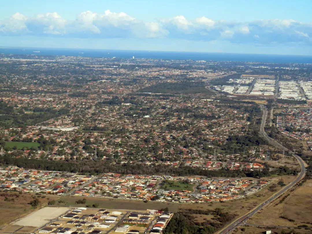
Houses, lots and streets in Beechboro and Caversham, seen from the air
Plate 02Lots & streets from above, Beechboro
04How a planning project runs

From first advice to a planning decision

Most planning work follows the same line. Not every project needs every step, and we will tell you which ones yours does.

  1. Stage 01

    Site check & advice

    What the land allows: zoning, density, lot yield and constraints, with heritage and ecology checked in‑house. You get a clear approval pathway before anything is designed or lodged.

  2. Stage 02

    Application & reports

    A planning report and justification against the local planning scheme and the R‑Codes, coordinated with your surveyor, architect and technical consultants.

    • DevelopmentLocal government, a DAP or the WAPC
    • SubdivisionThe WAPC, on Form 1A
  3. Stage 03

    Assessment

    Referrals, advertising and requests for further information. We answer the assessing officer's questions and represent you at council or panel where needed.

  4. Stage 04

    Decision & conditions

    Conditions managed and cleared. If a condition is unworkable or the application is refused, there are review rights, including at the State Administrative Tribunal within 28 days.

Statutory clockPeriods set by legislation, in days
Development application: local government60 days, or 90 days if advertised or referred
Subdivision: referral commentsLocal government and agencies comment within 42 days
Subdivision: WAPC decision90 days, unless a longer period is agreed in writing
Significant development: WAPCPart 11B, 120 days from acceptance for assessment
Review at the State Administrative TribunalApply within 28 days of the decision

These are statutory periods, not forecasts of how long an application will take. The clock can pause while further information is provided, and longer periods can be agreed in writing. Read more in our guide to development approval in WA.

05Planning framework

WA planning legislation & policy framework

Planning decisions in WA rest on layers: the Act and its regulations, region and local planning schemes, and State planning policies. These are the instruments our applications and reports are written against.

  • WA ActPlanning and Development Act 2005The principal planning law. It sets up the WAPC, region and local planning schemes, subdivision approval and development control, the Part 11B significant development pathway, and review of decisions by the State Administrative Tribunal.
  • WA RegulationPlanning and Development (Local Planning Schemes) Regulations 2015The deemed provisions in Schedule 2 form part of every local planning scheme in WA. They set out when development approval is needed, the exemptions, and how applications are advertised, assessed and decided.
  • WA RegulationPlanning and Development (Development Assessment Panels) Regulations 2011Development Assessment Panels. Since 1 March 2024 they have been opt‑in for development of $2 million or more, through three panels: Metro Inner, Metro Outer and Regional.
  • Region SchemeMetropolitan Region SchemeThe legal basis for planning in the Perth metropolitan region, dividing it into broad zones and reservations. Local planning schemes must be consistent with it.
  • State PolicyState Planning Policy 7.3 Residential Design CodesThe R‑Codes. Volume 1 covers single houses, grouped dwellings and multiple dwellings at R60 and below; Volume 2 covers multiple dwellings at R80 and above. Draft changes are open for comment until 26 February 2027.
  • State PolicyOperational Policy 1.1 Subdivision of Land (General Principles) & Operational Policy 2.2 Residential SubdivisionThe WAPC's policies for assessing subdivision. A draft released in October 2026 proposes moving the provisions of Operational Policy 2.2 into Operational Policy 1.1 and the R‑Codes.
  • State PolicyState Planning Policy 7.0 Design of the Built EnvironmentThe lead policy of Design WA, which guides our urban design and built form advice alongside local design guidelines.
  • LocalLocal planning schemes & local planning policiesEach local government's scheme sets zoning, land use permissibility and density codes, supported by local planning policies, structure plans and local development plans.

Aboriginal heritage, historic heritage and the clearing of native vegetation are covered by separate laws, and our Trace Archaeology and Trace Ecology teams advise on them. Our guide to rezoning and scheme amendments explains how a scheme is changed.

Plate 03Station precinct, Cockburn Central
Planning, heritage & environment

One point of contact for the whole job

Heritage and environmental specialists work in the same office. When a site also needs an Aboriginal heritage check, a heritage impact statement or a flora and fauna survey, Trace Archaeology and Trace Ecology can be brought in from the start, with one brief and reports that line up with each other.

Client Reviews & Testimonials

08Questions

Common questions about town planning in Perth

Short answers to the questions landowners and builders ask first. If yours is not here, call us on (08) 9446 6185.

The coastline of Cockburn Sound and the suburbs behind it, seen from the air
Plate 04From shoreline to suburb, Cockburn Sound
Can I subdivide my block in Perth?
It depends mainly on your R‑Code, the size, frontage and access of your lot, and whether services such as sewer are available. Can I subdivide my block? explains how to check.
Who approves a subdivision in WA?
The Western Australian Planning Commission (WAPC) decides subdivision applications, not the local council. It refers each application to the local government and relevant agencies, such as servicing authorities, for comment before making its decision.
How long does a subdivision application take?
Referral agencies generally have 42 days to comment, and the WAPC has a statutory period of 90 days to decide an application. Subdivision in WA: step by step covers the whole process.
Do I need a town planner for a development application?
It is not a legal requirement. A planner can check your proposal against the R‑Codes and the local planning scheme, prepare the application and respond to requests from the local government.
What do the October 2026 draft R‑Codes mean for me?
On 24 October 2026 the State Government released draft R‑Codes for consultation. Consultation closes on 26 February 2027, and the current R‑Codes apply until changes are adopted. See R‑Codes explained.
Do you work outside Perth?
Yes. Trace Planning works across Perth and in regional cities and towns throughout Western Australia. We work only in WA.

Every development approval starts with the right conversation

Whether you're a landowner, builder or developer, Trace Planning can work out what your land allows and take your application through to a decision. Talk to our team today, with no obligation.