

If you own or are looking at a residential block in Western Australia, its R-Code is one of the first things to check. The code shapes how many dwellings the land can hold, how small new lots can be and which design rules apply. This guide explains how the codes work and where to check your own property.
What is an R-Code?
The Residential Design Codes (the R-Codes) are the WA Planning Commission's statewide rules for residential development. Volume 1 covers single houses and grouped dwellings at every density, and multiple dwellings (apartments) in areas coded R10 to R60. Volume 2 covers apartments in areas coded R80 and above.
The R-Codes do not say which code applies to your land. Your local government's local planning scheme does that, by giving residential land a density code such as R20, R30 or R40. The R-Codes then attach requirements to each code. The higher the number, the smaller the site area each dwelling needs.
The current document is R-Codes Volume 1, Version 3, published 10 April 2026. It is split into four parts:
- Part A explains how the codes operate and when approval is needed.
- Part B applies to single houses in areas coded R40 and below, and to grouped and multiple dwellings in areas coded R25 and below.
- Part C applies to single houses in areas coded R50 and above, grouped dwellings in areas coded R30 and above, and multiple dwellings in areas coded R30 to R60.
- Part D sets the site area requirements for all residential development.
What R20, R30 and R40 allow
Part D, clause 1.1 and Table D set two site area figures for single houses and grouped dwellings at each code:
- Minimum site area: the smallest area any one dwelling's site can be.
- Average site area: the average area across all the dwellings or lots in the proposal.
Both have to be met. For a single house, the site area is the area of its green title or survey-strata lot. For a grouped dwelling, it is the land the dwelling occupies plus any other areas set aside for the exclusive use of its occupants.
- R10: minimum 875 m², average 1,000 m²; single house lot or rear battleaxe 925 m², frontage 20 m
- R12.5: minimum 700 m², average 800 m²; single house lot or rear battleaxe 762.5 m², frontage 17 m
- R15: minimum 580 m², average 666 m²; single house lot or rear battleaxe 655 m², frontage 12 m
- R17.5: minimum 500 m², average 571 m²; single house lot or rear battleaxe 587.5 m², frontage 12 m
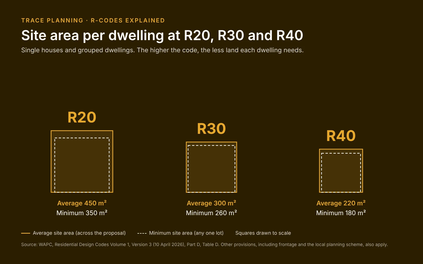
- R20: minimum 350 m², average 450 m²; single house lot or rear battleaxe 450 m², frontage 10 m
- R25: minimum 300 m², average 350 m²; single house lot or rear battleaxe 425 m², frontage 8 m
- R30: minimum 260 m², average 300 m²; single house lot or rear battleaxe 410 m²
- R35: minimum 220 m², average 260 m²; single house lot or rear battleaxe 395 m²
- R40: minimum 180 m², average 220 m²; single house lot or rear battleaxe 380 m²
- R50: minimum 160 m², average 180 m²; single house lot or rear battleaxe 160 m²
- R60: minimum 120 m², average 150 m²; single house lot or rear battleaxe 120 m²
- R80: minimum 100 m², average 120 m²; single house lot or rear battleaxe 100 m²
Single house lot, rear battleaxe and frontage figures apply to single houses only.
Source: Western Australian Planning Commission, Residential Design Codes Volume 1, Version 3 (published 10 April 2026), Part D, clause 1.1 Site area, Table D "Site area requirements", pages 117–118. Figures are for single houses and grouped dwellings. Table D also sets lower-density codes (R2, R2.5 and R5, minimum site area only), R100-SL (80 m² minimum, no average), and separate figures for multiple dwellings. Checked 16 October 2026.
A worked example. At R20, two lots must each be at least 350 m² and must average 450 m². That means the parent lot needs 900 m² of site area before it can be split into two under the deemed-to-comply standard. This is the requirement the State Government has proposed changing (see below).
A few details in clause 1.1 matter on real lots:
- In areas coded R40 and below, a rear battleaxe lot's access leg counts toward its site area, provided it is no more than 20 per cent of the required area (C1.1.3 ii).
- The WAPC, in consultation with the local government, may approve lots up to 5 per cent below Table D, but only where this achieves a listed outcome, such as protecting a heritage or environmental feature (P1.1.2).
- Some codes allow reduced site areas for aged or dependent persons', single bedroom, small and accessible dwellings, subject to conditions (C1.1.5 to C1.1.7).
What may change
On 2 July 2026 the Minister for Planning and Lands announced proposed R-Codes reforms, including removing the average lot size requirement for R20 and below. The Government said this would let owners of 700 m² blocks subdivide, down from the current 900 m². The Department of Planning, Lands and Heritage review page (updated 7 August 2026) says public consultation is expected in late 2026 and changes are expected to take effect from mid to late 2027, subject to approval. Until then, applications are assessed under the current framework. We cover the proposal in more detail in The 700sqm rule explained.
Dual coding explained
Some properties show two codes, such as R20/40 or R20/30. This is called dual or split coding, and it is set by the local planning scheme, not the R-Codes.
In the two examples below, the lower code is the default. The higher code is only available where a proposal meets extra requirements set out in the scheme or a local planning policy. For example:
- The Town of Bassendean information sheet (July 2023) says development under Local Planning Scheme No. 10 must conform to the lower code unless Council decides development to the higher code is acceptable. The criteria include enough street frontage for at least two dwellings side by side, its sustainable development policy, and Part C of the R-Codes.
- The City of Kalamunda applies dual codes such as R20/R40 in parts of Forrestfield, Kalamunda, High Wycombe and Maida Vale. The higher code applies only if an owner shows the proposal meets the higher-code requirements in its scheme and Dual Density Design Guidelines.
The conditions differ between local governments. If your lot is dual coded, read the scheme clause and any related policy before assuming the higher code applies.
How to find your property's R-Code
- Your local government's online map. Many councils publish zoning and R-Code information online. The City of Melville, for example, uses IntraMaps.
- PlanWA. The Department of Planning, Lands and Heritage's PlanWA map viewer shows local planning schemes, region schemes and heritage information for any land parcel in the State. Its address search uses the address on the Certificate of Title, which can differ from the postal address.
- The scheme itself. The local planning scheme text and maps are the formal source. If you see a dual code, structure plan or special control area, ask the local government's planning team how it applies.
R-Codes, subdivision and development approval
Subdivision. The WAPC determines freehold and survey-strata subdivision applications. It refers each one to the local government and service providers, then approves it (with or without conditions) or refuses it. Once conditions are cleared, the WAPC endorses the final plan and titles can be issued. Approval for five lots or fewer is valid for three years. Table D is the starting point for whether proposed lot sizes comply.
Development approval. Under the R-Codes, a development application is required where the local planning scheme requires one. Each design element in the R-Codes has two pathways:
- Deemed-to-comply: a set of measurable standards. If a proposal meets them, it complies.
- Design principles: a merit-based alternative. Where an element does not meet the deemed-to-comply standard, the applicant shows how it meets the design principle, and the decision-maker judges that element only.
A single house that meets all deemed-to-comply provisions may not need development approval, although a scheme can still require it. Grouped dwellings and other residential development need development approval.
Other things that limit a block
The R-Code is only one layer.
- Heritage listings. A heritage-protected place (as defined in the Planning and Development (Local Planning Schemes) Regulations 2015) can need development approval for works that would otherwise be exempt.
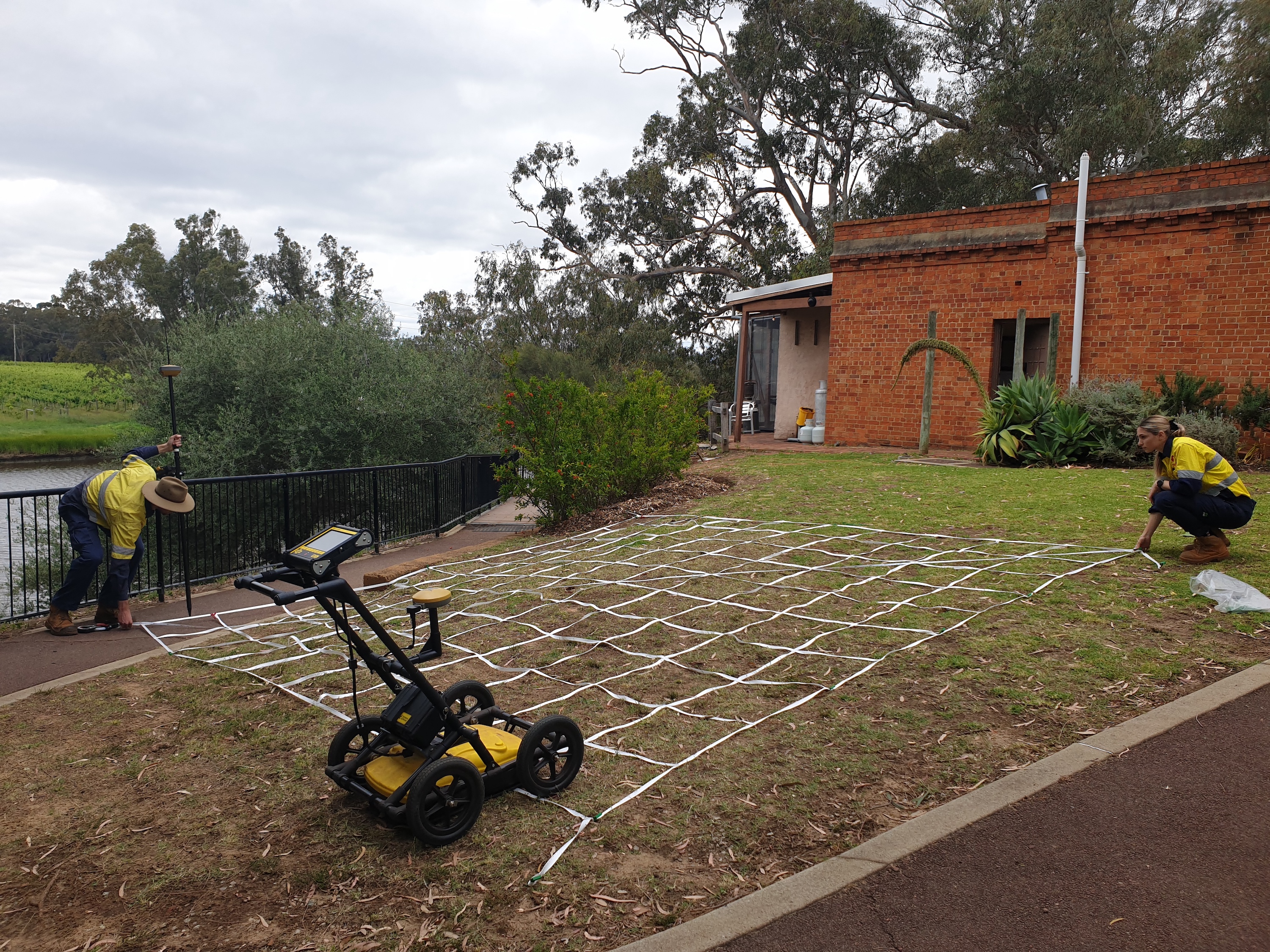
- Aboriginal heritage. Under the Aboriginal Heritage Act 1972, landowners must not knowingly damage an Aboriginal site. Ministerial consent under section 18 may be needed. The Department provides an online search tool.
- Trees and vegetation. Some local governments have tree retention policies. Clearing native vegetation can trigger separate environmental approvals.
- Easements and title. Easements, restrictive covenants and other title interests can limit where you can build.
- Bushfire. Land on the Map of Bush Fire Prone Areas can be subject to State Planning Policy 3.7 and a bushfire attack level (BAL) assessment. The current map came into effect on 13 December 2025.
- Scheme provisions. Special control areas, structure plans, local development plans and local planning policies can add or vary requirements.
When to talk to a planner
Talk to a planner when your lot is dual coded, is close to the Table D figures, has a battleaxe or irregular shape, or has one of the constraints above. Trace Planning can confirm the codes and constraints that apply, advise on the deemed-to-comply and design principles pathways, and prepare subdivision and development applications. Trace's heritage and ecology teams can look at those constraints alongside the planning advice. Contact us to talk through your site.
This guide is general information about how the R-Codes work. It is not legal or planning advice for a specific site. Requirements change, so check the current documents before relying on them.
Frequently asked questions
What does R20 zoning mean in WA?
R20 is a residential density code set by the local planning scheme. Under Table D of R-Codes Volume 1 (April 2026), each single house or grouped dwelling at R20 needs a minimum site area of 350 m², and the average across a proposal must be at least 450 m².
What is the minimum lot size for R20?
The minimum site area is 350 m² per dwelling, with a 450 m² average. In practice, splitting one R20 lot into two under the deemed-to-comply standard needs 900 m². The State Government has proposed removing the average for R20 and below, but that change is not yet in effect.
What does R30 zoning mean?
At R30, single houses and grouped dwellings need a minimum site area of 260 m² and an average of 300 m². Grouped dwellings at R30 are assessed under Part C of the R-Codes, while single houses at R30 are assessed under Part B.
What does R40 zoning mean?
At R40, the minimum site area is 180 m² and the average is 220 m² per single house or grouped dwelling. Multiple dwellings at R40 have a separate average site area of 115 m².
What does dual coding like R20/40 mean?
The property has a base code (R20) and a higher code (R40) set by the local planning scheme. The lower code applies unless the proposal meets the conditions the scheme or a local planning policy sets for the higher code. Those conditions vary between local governments.
How do I find the zoning and R-Code for my property in Perth?
Check your local government's online mapping tool, or use the State's PlanWA map viewer. The local planning scheme text and maps are the formal source, so confirm with the local government if anything looks unclear.
References
All accessed 16 October 2026.
- Western Australian Planning Commission, Residential Design Codes Volume 1, Version 3, published 10 April 2026 (Part A cl. 1.4, 2.1.1, Figure 2.1; Part D cl. 1.1 and Table D; Appendix definitions). wa.gov.au: R-Codes Volume 1 (April 2026)
- Department of Planning, Lands and Heritage, Residential Design Codes document collection (last updated 12 August 2026). wa.gov.au: Residential Design Codes
- Government of Western Australia, media statement, Planning code reforms to unlock infill housing opportunities, 2 July 2026. wa.gov.au: media statement
- Department of Planning, Lands and Heritage, Residential Design Codes Review (last updated 7 August 2026). wa.gov.au: R-Codes review
- Western Australian Planning Commission, Application Guide: Subdivision Applications and Fees, Version 10.3, July 2023. wa.gov.au: subdivision application guide
- Department of Planning, Lands and Heritage, PlanWA (last updated 27 March 2025). planning.wa.gov.au: PlanWA
- Town of Bassendean, Information Sheet: Split Residential Density Coded Land, July 2023. bassendean.wa.gov.au: split coding
- City of Kalamunda, Dual Density Design Guidelines (Amendment 82 gazetted 6 February 2018). kalamunda.wa.gov.au: dual density
- City of Melville, Online maps and zoning. melvillecity.com.au: maps and zoning
- Department of Planning, Lands and Heritage, Aboriginal Heritage Act 1972 (last updated 10 March 2026). wa.gov.au: Aboriginal Heritage Act 1972
- Department of Fire and Emergency Services, Bushfire prone areas. dfes.wa.gov.au: bushfire prone areas
- Planning and Development (Local Planning Schemes) Regulations 2015, document collection. wa.gov.au: LPS Regulations 2015



.JPG)