

Why old burial grounds need investigating before works
Councils, cemetery trustees, churches and developers often face the same problem. A path, drain, memorial wall, fence or footing is planned in or beside an old burial ground, and nobody can say what lies beneath.
Surface evidence is a poor guide. Markers can be lost or relocated. Burial registers may be incomplete. Early burials can extend past today's fence line. The Cemeteries Act 1986 requires burials to take place in proclaimed cemeteries, with records kept in perpetuity. But older and informal burial places can predate those records or sit outside them.
Disturbing a grave by accident is distressing for descendants and communities. It can also halt a project while authorities are notified and a way forward is agreed. Investigating first gives you an evidence base for design and for the approvals that follow.
How ground penetrating radar works
A GPR unit sends short pulses of electromagnetic energy into the ground and records what comes back. Reflections occur where the electrical properties of the ground change. The sharper the contrast, the stronger the reflection. The time each reflection takes to return is used to estimate its depth.
Antenna frequency is the main trade-off. The antenna sets the system's vertical and horizontal resolution, and the choice of frequency should suit the size and depth of the features sought and the expected signal loss. Higher frequencies resolve finer detail. Lower frequencies reach deeper but blur small features. One recent cemetery guideline notes that low-frequency antennas (100 to 250 MHz) do not give enough resolution to locate individual burials, and points to a mid-range antenna for most cemetery work.
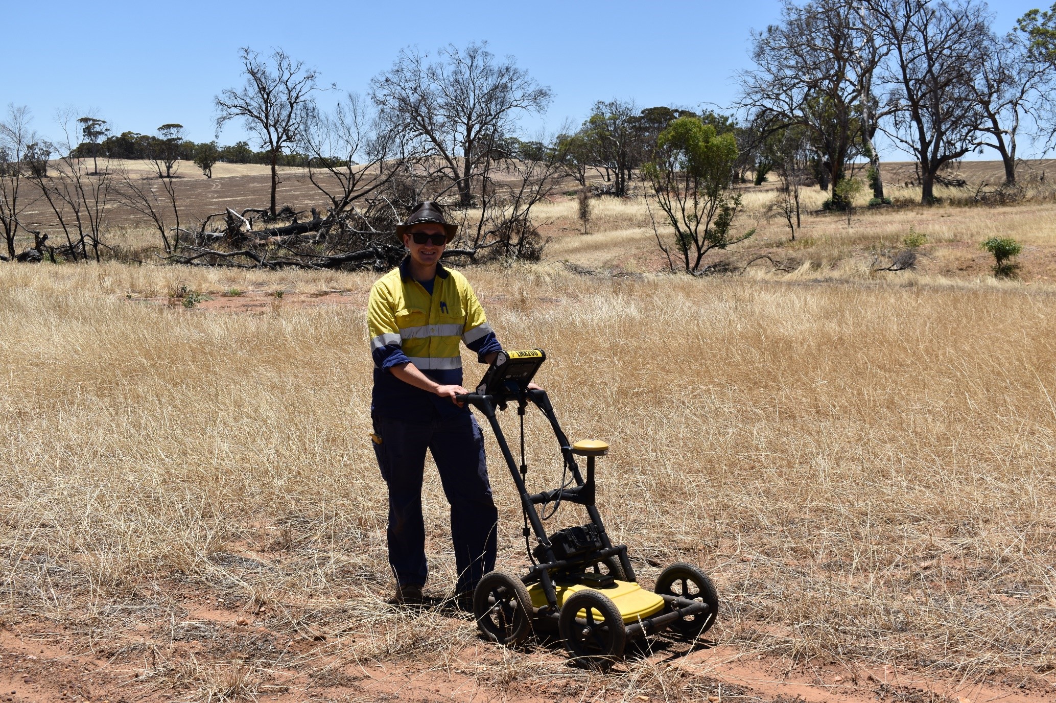
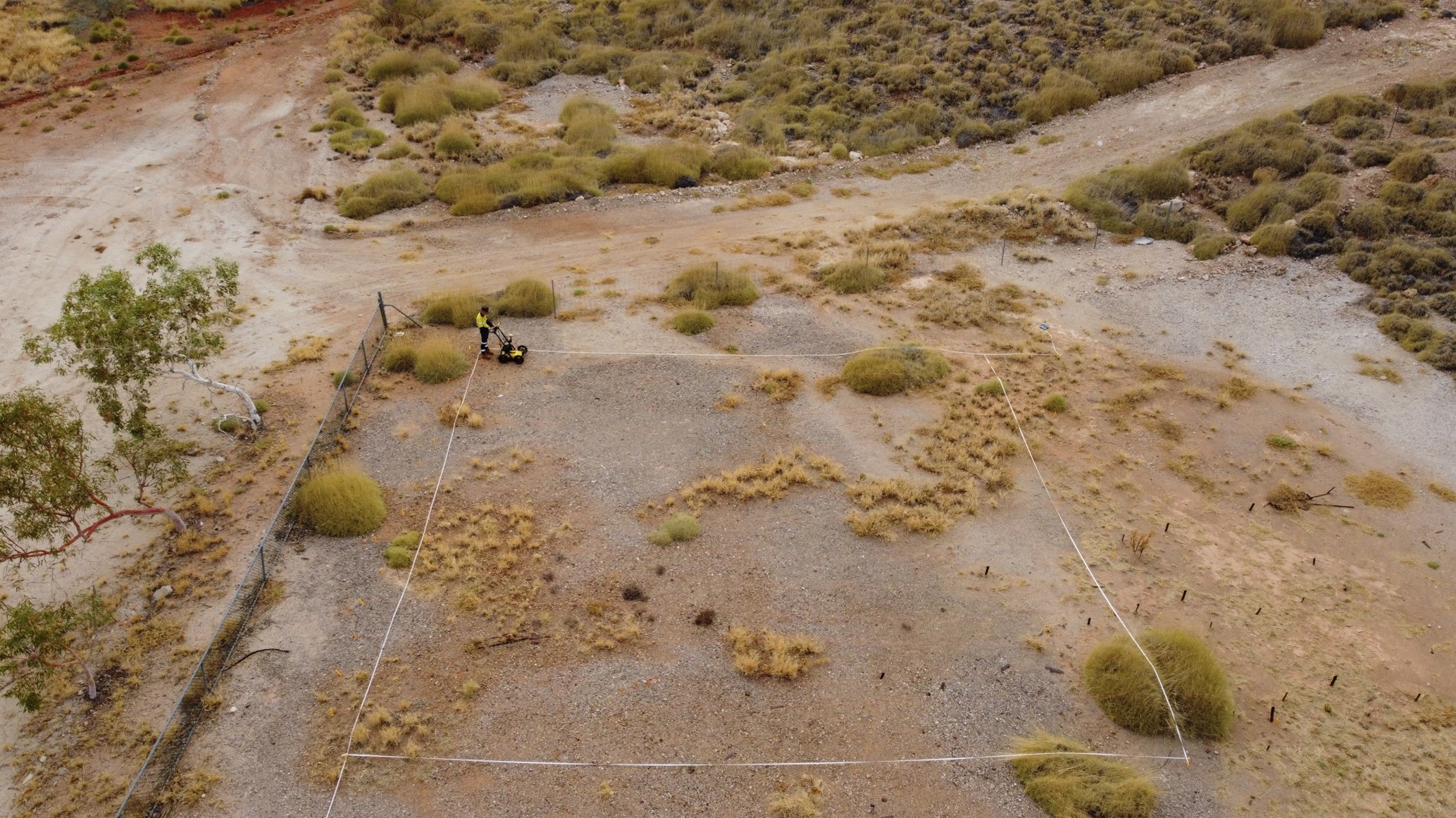
For burial grounds, data are collected along closely spaced parallel lines across a grid. The lines are combined into a 3D data block that can be cut into horizontal time slices or depth slices. These plan views show patterns that single profiles can miss, such as a row of grave-shaped anomalies. European guidelines suggest line spacing of about 0.25 m where the shape of features matters.
What GPR can and can't tell you
GPR does not see bodies. Most geophysical methods respond to the soil disturbed when a grave was dug, not to the remains themselves. That only works where the grave fill contrasts with the ground around it.
So the honest output of a survey is a map of anomalies consistent with graves. Each one needs interpretation by someone who understands both the data and burial practice.
Ground conditions matter a great deal:
- Signal loss is usually strong in wet or salty soils, and salinity reduces penetration depth.
- Waterlogged, uneven or highly conductive ground limits results, and clay-rich soils are listed among sub-optimal conditions for remote sensing.
- Dry, coarse-textured soils tend to be more favourable, although detection is never assured.
- Mixed modern fill makes grave fill harder to distinguish.
Two cautions follow. First, a lack of anomalies is not proof that no graves are present. Second, an anomaly is not proof that a grave is present. Confirmation needs direct investigation, under the right approvals.
How a cemetery GPR survey is planned and run
Planning starts at the desk. Burial registers, cemetery plans, historical aerial photographs and earlier reports help define the survey area and the likely grave alignment. Many historic Christian burials lie roughly east–west, so survey lines are run across that alignment where possible.
Next comes a check of site conditions: soil, surface obstructions, trees, services, and how much fill may have been added over time. This shapes the antenna choice, line spacing and grid layout.
On site, the grid is set out and tied to survey coordinates so any anomaly can be found again later. Data are collected line by line across the grid.
Field viewing alone is not enough for historic cemeteries. The data are processed and interpreted afterwards, before conclusions are drawn.
Our ground penetrating radar service covers survey design, fieldwork and interpretation for cemeteries and other heritage sites.
What you receive
A useful GPR report gives you:
- plans of the survey area with interpreted anomalies overlaid on a site plan;
- example radar profiles and depth or time slices;
- each anomaly ranked by how likely it is to be a grave (for example high, medium or low), with the criteria explained;
- areas that could not be surveyed, or gave poor data, clearly marked;
- recommendations for design changes, further investigation or monitoring.
Good interpretation separates what the data show from informed judgement. You should be able to see which is which.
Legal and cultural obligations in WA
Several laws can apply at once, depending on the site and what is found. This is general information, not legal advice.
Cemeteries Act 1986. Proclaimed cemeteries are managed by trustees. Exhumation needs a written order from the Minister under section 58.
Heritage Act 2018. If the cemetery is on the State Register of Heritage Places, decision-makers must refer proposals likely to affect it to the Heritage Council for advice. The Act includes an offence for damaging a registered place. Archaeological excavation at a registered place that needs no other approval can be authorised by a section 79 permit from the Heritage Council.
Local heritage lists. Local governments must keep a heritage list under the planning deemed provisions. Places on the list can need development approval for works that would otherwise be exempt. Check with the local government early.
Aboriginal heritage. Aboriginal burials can occur both inside and outside formal cemeteries. Under section 15 of the Aboriginal Heritage Act 1972, anyone who knows of Aboriginal burial grounds must report them to the Registrar of Aboriginal Sites or a police officer, unless they reasonably believe the Registrar already knows. Excavating or altering an Aboriginal site without authorisation is an offence under section 17. The Department of Planning, Lands and Heritage asks anyone who finds ancestral remains not to interfere with the burial area and to notify both the Registrar and WA Police immediately. Where Aboriginal burials may be present, Traditional Owners should be involved in deciding whether and how any survey and follow-up work proceeds.
Human remains. Under section 17 of the Coroners Act 1996, a person must immediately report a death that is or may be reportable to a coroner or the police. If bone that may be human is uncovered, stop work in that area, protect the find and contact WA Police.
A GPR survey does not disturb the ground. Ground-truthing, excavation and construction are where these approvals usually come into play.
Combining GPR with archival research and monitoring
GPR works best as one line of evidence among several. Burial registers, cemetery plans, church and council records and historical photographs help explain anomalies and show where to look. Our desktop and archival research covers this step.
Other geophysical methods respond to different ground properties. Cemetery guidance recommends more than one instrument where appropriate. Where GPR is unsuitable, it suggests magnetic gradiometry paired with electrical resistivity or electromagnetic survey.
When works go ahead, archaeological monitoring puts a qualified archaeologist beside the excavator. They can stop work if a grave cut or bone appears. In 2022 Trace combined GPR survey with archaeological monitoring at Broome Pioneer Cemetery for the Shire of Broome, where new memorial footings were installed within a historic cemetery. Our team includes archaeologists and osteologists, so a possible bone find can be identified quickly and reported correctly.
Planning works in or near an old burial ground? Contact us to talk through the site and whether GPR suits it.
Frequently asked questions
Can GPR find unmarked graves?
GPR can identify anomalies consistent with graves where the grave fill contrasts with the surrounding soil. It does not detect bodies directly. Results need interpretation, and some graves may not show at all.
How deep can GPR see?
It depends on the antenna and the ground. Wet, salty or clay-rich soils reduce penetration and clarity. A site review before the survey sets realistic expectations for that site.
Do I need approval for a GPR survey in a cemetery?
GPR does not disturb the ground. You still need permission from the cemetery's trustees or land manager. Talk with descendants or Traditional Owners where relevant. Formal approvals usually apply to excavation or works that follow.
What happens if human remains are found during works?
Stop work in that area and protect the find. Contact WA Police. If the remains may be Aboriginal, also notify the Registrar of Aboriginal Sites at the Department of Planning, Lands and Heritage.
References
- Bladon, P., Moffat, I., Guilfoyle, D., Beale, A. & Milani, J. (2011). Mapping anthropogenic fill with GPR for unmarked grave detection (Western Australian case study). Exploration Geophysics 42(4): 249–257. doi.org
- Schmidt, A., Linford, P., Linford, N., David, A., Gaffney, C., Sarris, A. & Fassbinder, J. (2015). EAC Guidelines for the Use of Geophysics in Archaeology: Questions to Ask and Points to Consider. Europae Archaeologiae Consilium / International Society for Archaeological Prospection. archprospection.org
- Council of Virginia Archaeologists, Cemetery Committee (2025). Cemetery Delineation Guidelines – remote sensing (draft for Virginia Department of Historic Resources review, 23 June 2025). dhr.virginia.gov
- USDA Natural Resources Conservation Service (2021). GPR Soil Suitability Maps fact sheet. nrcs.usda.gov
- Government of Western Australia. Burials and exhumations. wa.gov.au
- Heritage Act 2018 (WA). legislation.wa.gov.au
- Heritage Council of WA / DPLH. Archaeological excavation permit application (section 79, Heritage Act 2018), 2026. wa.gov.au
- Heritage Council of WA / DPLH (2021). Guidelines for Establishing a Heritage List. wa.gov.au
- Department of Planning, Lands and Heritage. Aboriginal sites, objects and ancestral remains. wa.gov.au
- Aboriginal Heritage Act 1972 (WA), ss 15–17. legislation.wa.gov.au
- Coroners Act 1996 (WA), s 17. legislation.wa.gov.au



.JPG)